Iowa State Fairgrounds
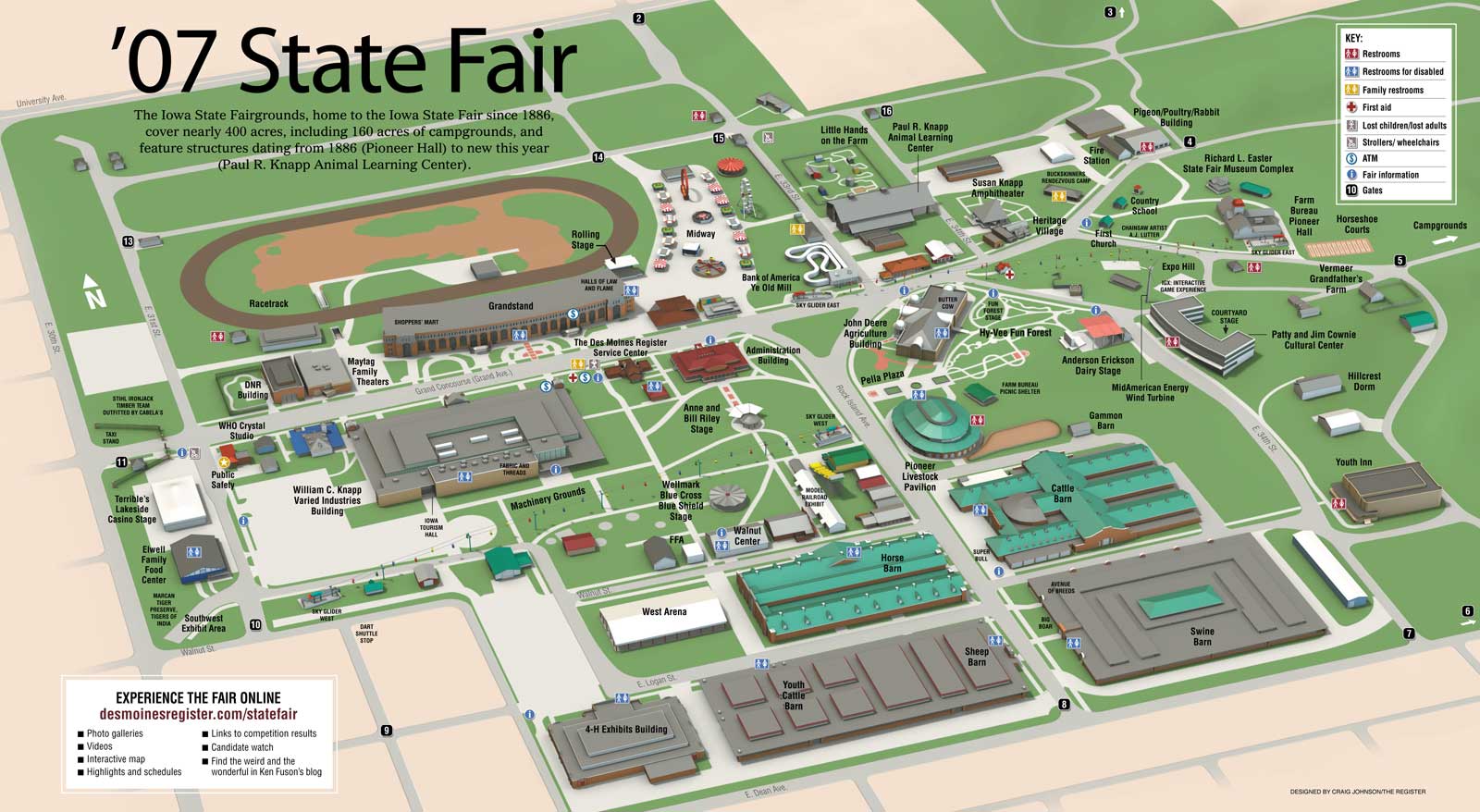
The annual state fair is kind of a big deal in Iowa. It gets made fun of a lot, but it draws well over a million people during it’s 10-day run every year. I know I never miss it. This was a fairly ambitious project. I traipsed all over the property taking reference photos and stitched together Google map satellite images to use as a source for tracing all those roads and sidewalks onto my ground texture map.
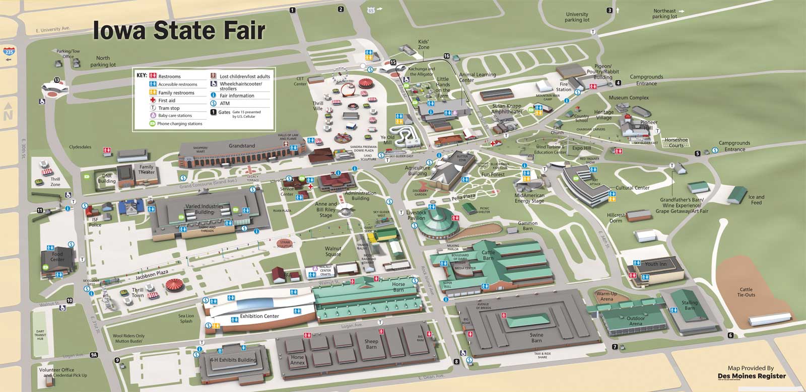
It wouldn’t be inaccurate to say I kind of rue the day I had the idea to do this. For years I had to go into the file every summer and update it with whatever improvements the fair had made. To see what I mean, I’ve included the first version and the 2019 version of the illustration. Changes include removal of the track, new gates, the new Equestrian Center and the completely redesigned grounds next to the Varied Industries Building.
There were a few changes for 2019 that didn’t make it into the update simply because I technically no longer work for the Des Moines Register, so this technically isn’t my responsibility any more. I’m not sure anyone is upating it anymore, which is too bad, because after I left, the Register struck up a deal with the fair to use this map in an official capacity. It was a bit of a shock to turn aroud after buying my corndog a couple of years ago and see my map on a 6-foot-high billboard on the fairgrounds. (Kind of cool, too. Don’t tell anyone I said so.)
Fairgounds Map (pdf)